Exercise 6 - Metadata via OGC API - Records
OGC API - Records provides a Web API with the capability to create, modify, and query metadata on the Web:
- Read the OGC API - Records: Part 1: Core specification at the OGC website.
OGC API - Records uses OGC API - Features as a building block, thus enabling streamlined deployment and integration for clients and users.
pygeoapi support
pygeoapi supports the OGC API - Records specification, using Elasticsearch and TinyDB as core backends.
Note
See the official documentation for more information on supported catalogue/metadata backends
Publish metadata records in pygeoapi
With pygeoapi we can setup OGC API - Records using any supported data provider. In this exercise we will use the TinyDB
Catalogue backend. We will use the sample catalogue in workshop/exercises/data/tartu/metadata/catalogue.tinydb.
Update the pygeoapi configuration
Open the pygeoapi configuration file in a text editor. Add a new dataset section as follows:
Save the configuration and restart Docker Compose. Navigate to http://localhost:5000/collections to evaluate whether the new dataset has been published.
Metadata formats
By default, pygeoapi supports and expects the OGC API - Records core record model and queryables. For additional metadata formats, you can develop your own custom pygeoapi plugin, or convert your metadata to OGC API - Records core record model before adding to pygeoapi.
Install OWSLib
If you do not have Python installed, consider running this exercise in a Docker container. See the Setup Chapter.
Sample ISO 19139 to TinyDBCatalogue loader
It is possible to load more example ISO19139 metadata in a TinyDB database with the following script (raw):
If you do not have curl installed, copy the URL above to your web browser and save locally.
If you do not have Python installed, you can the loader by using the OWSLib Docker container. See the Setup Chapter.
Using the OWSLib Docker container to load metadata
cd workshop/exercises
docker run -it --rm --network=host --name owslib -v $(pwd)/data:/data python:3.10-slim /bin/bash
pip3 install owslib
apt-get update -y && apt-get install curl -y
curl -O https://raw.githubusercontent.com/geopython/pygeoapi/master/tests/load_tinydb_records.py
python3 load_tinydb_records.py /data/tartu/metadata/xml /data/tartu/metadata/catalogue.tinydb
cd workshop/exercises
docker run -it --rm --network=host --name owslib -v ${pwd}/data:/data python:3.10-slim /bin/bash
pip3 install owslib
apt-get update -y && apt-get install curl -y
curl -O https://raw.githubusercontent.com/geopython/pygeoapi/master/tests/load_tinydb_records.py
python3 load_tinydb_records.py /data/tartu/metadata/xml /data/tartu/metadata/catalogue.tinydb
Navigate to http://localhost:5000/collections/example_catalogue to evaluate whether the new metadata has been published to the collection.
pygeoapi as a CSW proxy
You can check the "pygeoapi as a Bridge to Other Services" section to learn how to publish CSW as OGC API - Records.
Client access
QGIS
QGIS supports OGC API - Records via the MetaSearch plugin. MetaSearch originally focused on Catalogue Service for the Web (OGC:CSW) only, but has been extended to OGC API - Records. MetaSearch is a default plugin in QGIS and requires no further installation.
Query OGC API - Records from QGIS
Follow these steps to connect to a service and query datasets:
- Locate the MetaSearch plugin in the Web menu or on the Toolbar
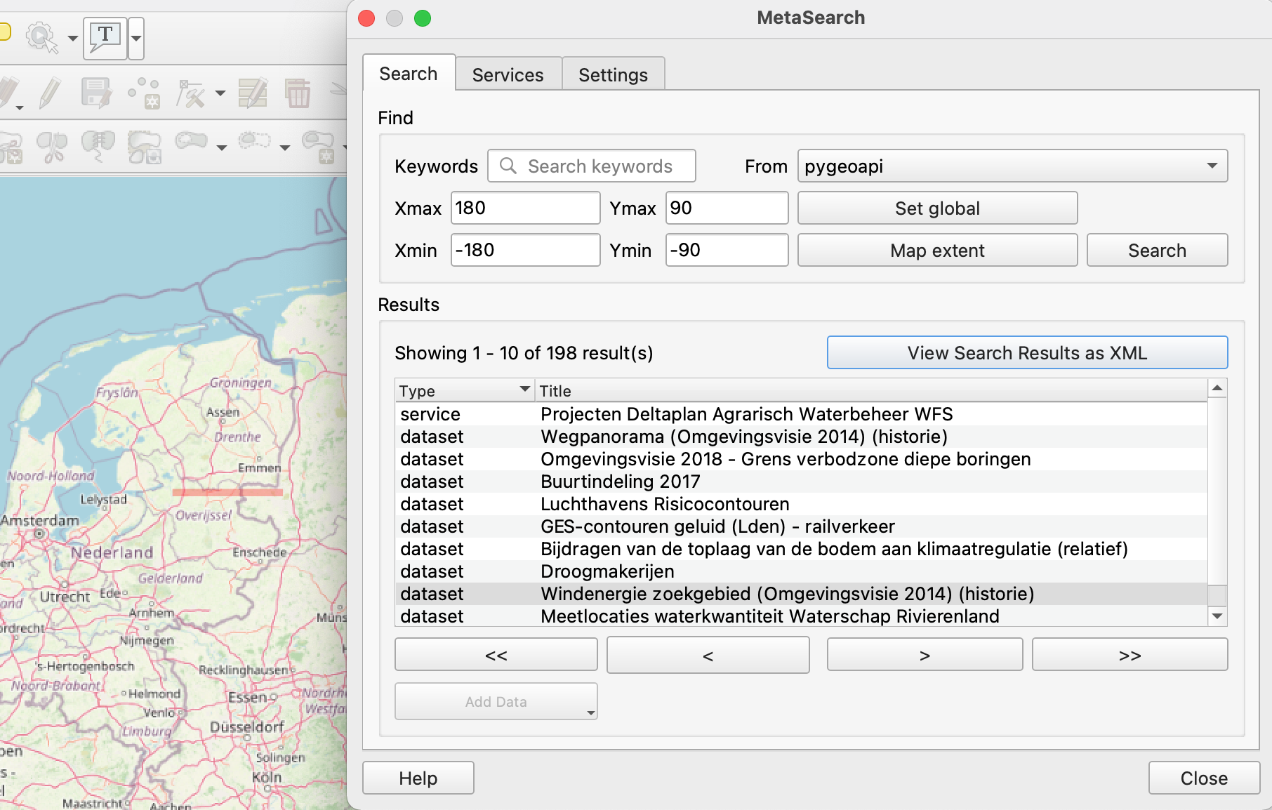
 . The main search panel will appear with the default MetaSearch catalogue list already populated.
- open the
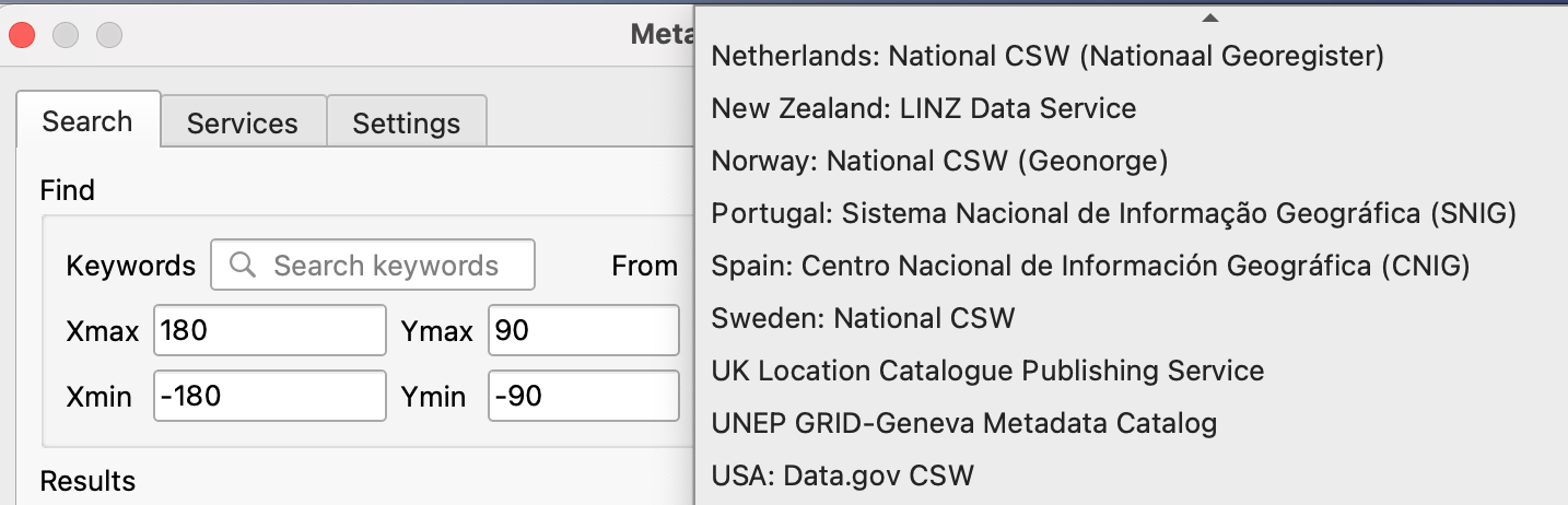
Servicestab, to find theNewbutton to create a new connection - add a connection to
https://demo.pygeoapi.io/master - click
Service Infoto get information about the service - return to the Search tab
- select the connection you have just created
- type a search term and click
search - notice that when you select a search result, a red footprint is drawn on the map highlighting the location of the dataset
OWSLib is a Python library to interact with OGC Web Services and supports a number of OGC APIs including OGC API - Records.
Interact with OGC API - Records via OWSLib
If you do not have Python installed, consider running this exercise in a Docker container. See the Setup Chapter.
Then start a Python console session with python3 (stop the session by typing exit()).
>>> from owslib.ogcapi.records import Records
>>> SERVICE_URL = 'https://demo.pygeoapi.io/master/'
>>> w = Records(SERVICE_URL)
>>> w.url
'https://demo.pygeoapi.io/master'
>>> dutch_metacat = w.collection('dutch-metadata')
>>> dutch_metacat['id']
'dutch-metadata'
>>> dutch_metacat['title']
'Sample metadata records from Dutch Nationaal georegister'
>>> dutch_metacat['description']
'Sample metadata records from Dutch Nationaal georegister'
>>> dutch_metacat_query = w.collection_items('dutch-metadata', limit=1)
>>> dutch_metacat_query['numberMatched']
198
>>> dutch_metacat_query['numberReturned']
1
>>> dutch_metacat_query = w.collection_items('dutch-metadata', q='Wegpanorama')
>>> dutch_metacat_query['numberMatched']
2
Note
See the official OWSLib documentation for more examples.
Summary
Congratulations! You are now able to publish metadata to pygeoapi.